The comprehensive AfriGIS Route Optimisation toolset incorporates basic point-to-point scheduling, as well as a more complex travelling salesperson solution. It's a simple, easy to use solution which can be implemented in days.
The AfriGIS Route Optimisation toolset integrates with various size businesses but primarily focuses on small to medium sized businesses, which develop a lot of their scheduling tools in-house. The solution is built on the AfriGIS Mapserver and Routing server technologies, serving thousands of routes to mobile navigation customers daily. It elegantly integrates user requirements for simple or more complicated routes in a single call.
Although simple and straightforward the solution caters for two of the most challenging problems:
Live and historic traffic
Arrivals can be predicted accurately with the toolset, thereby improving levels of service and customer satisfaction. This is done by integrating the live or historic traffic environment into the routing algorithms. Traffic is sourced on a national scale, in partnership with Altech Netstar Traffic, leaders in providing intelligent, real-time traffic data to South African road users.
Matching planned and actual scenarios
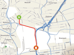
Carefully laid plans are often not executed and mostly this is only realised when calculating month end costs. The AfriGIS Route Optimisation toolset provides a simple way to resolve this. It integrates with AfriGIS Navigator, a smartphone and tablet software application that functions as a personal navigation device. The route or travel plan is sent to the mobile device of a driver which directs him or her with turn-by-turn voice navigation, without them ever having to type an address. The route is logged for analysis purposes and the driver's position can be viewed on a map in real time.
Taking all this to the final level, where AfriGIS sees the potential for huge optimisation is the integration with the AfriGIS Mobility Framework (AMF). The AMF is built for one of several mobile device platforms ranging from Blackberry through Android and iOS to Windows platforms. It deals with everything from finding addresses or assets, capturing data in the field, through to analysing and reporting there on. Data can range from an order, proof of delivery to asset verification and includes variables like photographs, barcodes and GPS positions.
The basic navigation tools are free of charge and can be upgraded to the more advanced solution which also takes LIVE traffic conditions into account. Driving directions can also be printed, emailed or sent to other industry standard connected navigation tools. Even a standard feature phone can be positioned and communicated to as part of the solution. Flexible billing capabilities exist and allows for payment per route or a bulk monthly subscription.
Magnus Rademeyer, MD of AfriGIS concludes: "We are excited about the capabilities of the Routing toolset for small and medium sized businesses. The integration capabilities with our mobility framework will also unlock a wealth of other benefits. As developers and customers integrate with the toolset and access the AfriGIS Mobility Framework, particularly the capabilities around finding addresses and analysing results, their service delivery will improve and operational costs will substantially decrease."
For more information visit the API website at http://myapi.afrigis.co.za and have a look at Routing and Traffic. An overview of the AfriGIS Mobility Framework can be seen on YouTube at http://youtu.be/sNT1liX7KTo
Other related videos can also be viewed on http://www.youtube.com/afrigis