Putco is South Africa’s oldest and largest bus company, operating 1,600 buses, employing over 4,200 people and transporting more than 230,000 commuters daily in Mpumalanga, Limpopo and Gauteng, covering over 90 million km’s per annum.
Moving forward is an integral part of the way Putco conducts business, not only in their day-to-day operations but in their vision around optimising services to commuters. Part of their long-term vision is to provide one-click access to their routing information to commuters, empowering them to plan their ideal trip.
AfriGIS shares in this vision and passion to give commuters easy access to routing information and planning. By capturing all existing Putco routes and linking relevant information, Putco can optimise their existing routes and schedules to fulfil commuter needs.
Existing routes can be viewed in relation to the changing environment to highlight gaps in services and to determine where demand exceeds supply. Bus trips can be adjusted to cater for different volumes on different routes at different times of the day, providing in the specific needs of commuters.
Road networks change over time and routes need to be adjusted accordingly to ensure optimised routing. This results in not only providing better service to commuters but also minimising expenses, which in the end filters down to commuters through savings on ticket prices.
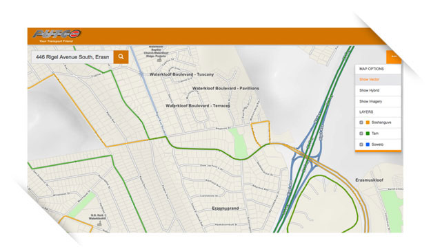
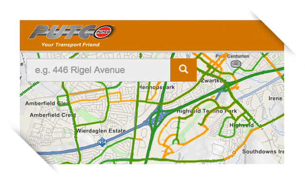
Commuters should be able to use route information captured and maintained to view routes, plan trips, determine bus movement and budget for trips.
If commuters know where buses are in relation to their location(s), they can plan accordingly and move forward innovatively from point A to B.
About the project
Phase 1 of the Geographic Information Systems (GIS) project has been completed successfully; all routes have been mapped. Phase 2, which will commence soon, comprise bus routing, a customer alert solution, call centre application and quick code (USSD) service. Putco has also partnered with Netstar in a live tracking project, including the usage of on-board cameras, which will link the AfriGIS project into the tracking project. This will improve Putco’s service delivery to passengers levels unsurpassed in the commuter bus passenger industry.
About AfriGIS
At AfriGIS we answer the where questions of your business by bringing quality location information to life.
We give easy access to quality location information and insights.
We do this by building great maps and software tools, adding third-party information and giving meaningful insights by summarising the patterns we see.
We deliver these answers to you as reports, or into your own solutions via our mapping and analytics software platforms.
Patterns relate to everything from where potential customers are, to improving the way you do business through geographic optimisation. Closest, shortest, fastest.
We do not believe in a one-size-fits-all approach and as such our solutions are modular and integrated, for you to choose what you want or simply ask us to discover the answers with you.
The AfriGIS product range and solutions are utilised by over 200 government, parastatals and corporate clients worldwide.
For innovative solutions visit www.afrigis.co.za.
Follow AfriGIS on Twitter: @afrigis.
Media Contact for AfriGIS:
Lydette Fouche
+27 87 310 6400
az.oc.sigirfa@ettedyl