AfriGIS data process, additions and features
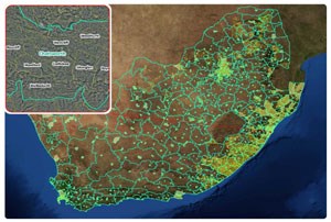
In the latest Data Release, AfriGIS added and updated a considerable volume of data, specifically in terms of the NAD (National Address Database), street names, street centre lines, points of interest, and suburbs. These include over 6000 new points of interest, more than 105,000 new NAD points, almost 3000 additional street links and 10,000 street- names and type updates.
"We continuously focus on re-evaluating and improving data to enhance the level of confidence we have in our data integrity. The dedicated focus was on updating the NAD in the City of Johannesburg and City of Cape Town, where we captured the majority of data. We also continued with our focus on updating farm names and made huge progress in this regard, with almost 8.1 million properties currently in the Cadastral dataset," Christopher Ueckermann, AfriGIS data manager, explained.
"We changed our data capturing and update processes to optimise our efforts. We compiled priority lists to determine areas of focus in updating and re-evaluating our data, in order to be more effective and produce better data. AfriGIS aims at always enhancing our data and appreciate client feedback, to enable us to better our data and processes for optimised data delivery," Ueckermann concluded.
AfriGIS Data utilised by SARS
South African Revenue Services' Harry Holtzhausen presented on how SARS uses AfriGIS datasets to improve and enhance their internal datasets for analyses and interpretation of data. They make use of the National Address Database, Cadastral and Deeds datasets and add their own internal datasets, in order to be able to highlight anomalies and derive interpretations on data. "We have a huge advantage by just using AfriGIS data. The biggest challenge was to get the internal SARS users to derive sufficient value from the data. In order to rectify this, maps were created on which users could play around and familiarise themselves with the power of maps and data. We are now moving in a new direction, which is more service based and the data provided by AfriGIS makes it possible to realise our vision," Holtzhausen said.
Streamline your business with Simseek
Brian Civin, AfriGIS's chief business officer, introduced the newly updated and launched Simseek product, which is in line with the AfriGIS focus of streamlining products and services and consolidate it into one portal for ease of use and deployment. "We realised that there is, in general, a lack of understanding of GIS. The end-user needs a tool that is intuitive and easy to use, to reap the full benefits of GIS. We are now at a point where all our products and services that have matured over time are streamlined into a single enterprise solution. In today's business everything is about streamlining," Civin commented.
AfriGIS currently boasts more than 20 datasets, maintenance releases occur on a quarterly basis and the use of datasets is governed by the AfriGIS Data License Agreement. To view datasets or to download the Data Catalogue, go to www.afrigis.co.za and select the Data tab.
Anyone interested in attending an AfriGIS Data Show can contact Heidi Witthoft at 087-310 6400 or az.oc.sigirfa@idieh. For more information on the complete AfriGIS Data offering, contact az.oc.sigirfa@stcudorp.